COVÊLO DE PAIVÓ
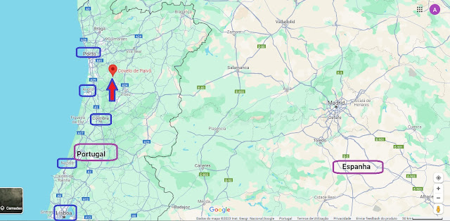
N 40.883591º, W 8.167685º
Covelo de Paivó was a Portuguese parish in the municipality of Arouca, with an area of 26.48 km² and 103 inhabitants (2011). Its population density was 3.9 inhabitants/km².
It belonged to the extinct municipality of Sul until 1853, when it was integrated into São Pedro do Sul. In 1917 it passed to the current municipality.
It was extinguished in 2013, as part of a national administrative reform, having been added to the parish of Janarde, to form a new parish called União das Freguesias de Covelo de Paivó and Janarde, of which it is the headquarters.
Heritage and places of tourist interest
Drave - abandoned village.
Regoufe
Pêgo Place
Regoufe tungsten mines
PR 13 - On the Path of Paivô
PR 14 - The Magic Village
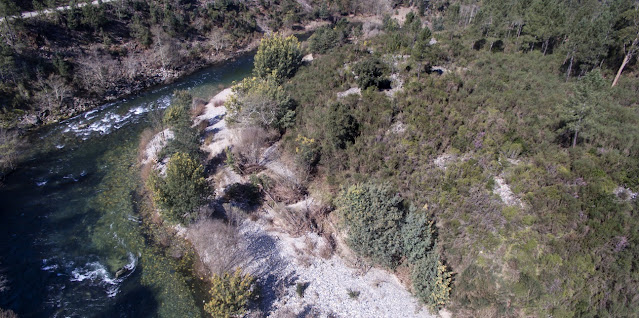
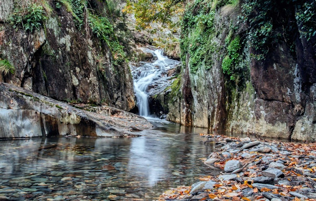
Paivô river beach
Saint Peter's Church (main church)
Chapel of Santo Amaro - in Regoufe
Chapel of Our Lady of Health - in Drave
💓💓💓💓💓
JANARDE
40,925721º N; W 8,149835º
Janarde was a Portuguese parish in the municipality of Arouca, with an area of 17.9 km² and 119 inhabitants (2011). Its population density was 6.6 inhabitants/km².
It was extinguished in 2013, as part of a national administrative reform, having been added to the parish of Covelo de Paivó, to form a new parish called União das Freguesias de Covelo de Paivó and Janarde with headquarters in Covelo de Paivó.
Patrimony
Church of Saint Barnabas (main church)
Santa Barbara Chapel
Cruise (Cruzeiro)
Section of the Paiva River and river beaches
💓💓💓💓💓
DRAVE
40,861157º N; N 8,117198º
Drave is an uninhabited village in a cave between Serra da Freita, Serra de São Macário and Serra da Arada, integrated into the Arouca Geopark and located in the Union of Parishes of Covelo de Paivó and Janarde, Municipality of Arouca, District of Aveiro.
It is a typical village where the houses are made of stone, called lousinha stone, with a schist roof. The streets are irregular.
The village is very isolated and without traces of modernity: it is not accessible by car, and the nearest village, Regoufe, is 4 kilometers away. There is no electricity, running water, sanitation, gas, mail, telephone and the cell phone network is scarce (only MEO). There are also no shops, so money is useless, nor are there clocks in the village.
Geography
The village of Drave surrounded by the Serras da Arada, Freita and S. Macário.
Drave is located in the center of the mountain formation formerly known as Monte Fuste, which divides the Douro and Vouga river basins, and is bordered to the north by the Arda river, to the east by the Sul river, to the south by the Vouga river and to the west by the Paiva river. The steep cliffs show blocks of granite or shale characteristic of the area. The place of Drave is located at around 600 meters of altitude in a valley, surrounded by high mountains that shade it during the winter. In the surrounding area, the gentler slopes stand out for their terraced agricultural use, while the steep slopes are occupied by a continuous vegetation cover, dominated by shrubs and low herbaceous species. In this unique landscape, the land is fertile due to the rivers and streams that run down the slopes. In Drave, the Palhais river runs on the north side, the Ribeirinho and the Bouça stream run along the east and south sides respectively, converging at the bottom of the village forming the Drave river, which develops over a 5 km route until it meets the Paivó river. , one of the tributaries of the Paiva River. In this region, the settlement of the valley, next to the rivers, is dispersed and the settlements are almost desertified. The places of Covelo de Paivó, Regoufe and Drave belong to the same parish, and Drave is more than 10 km from the village of Covelo de Paivó.
Chapel of Our Lady of Health in the village of Drave
The village develops along the slope forming an organic layout with around twenty properties. These are located along the road axes that surround the steep slope, located on small platforms adapted to the terrain. In the center of the village is the chapel, which stands out for its lime cladding and covered roof.


💓💓💓💓💓
SEARCH IN ALPHABETICAL ORDER
IN THE DISTRICT OF AVEIRO

Águeda;
Aguada de Baixo;
Albergaria-a-Velha;
Alvarenga + Paradinha;
Anadia;
Arões + Trebilhadouro;
Arouca + Meitriz;
Arouca Unesco Global Geopark;
Avanca;
AVEIRO;
Bussaco;
Castelo de Paiva;
Cortegaça;
Costa Nova;
Covelo de Paivó + Janarde + Drave;
Curia;
Esmoriz;
Estarreja;
Espinho;
Fábrica da Vista Alegre;
Freita Mountain (Serra da Freita);
Ílhavo;
Mealhada;
Murtosa;
Luso;
Oiã (Oliveira do Bairro);
Oliveira de Azeméis;
Oliveira do Bairro;
Ovar;
Palhaça (Aveiro);
Paramos;
Pateira de Fermentelos;
Praia da Barra;
Praia da Vagueira;
Ria de Aveiro;
Salreu;
Sangalhos;
Santa Maria da Feira;
São João da Madeira;
Sever do Vouga;
Silvalde;
Sosa (Vagos);
Vagos;
Vale de Cambra;
Válega;
Oliveira de Azeméis;
Oliveira do Bairro;
Ovar;
Palhaça (Aveiro);
Paramos;
Pateira de Fermentelos;
Praia da Barra;
Praia da Vagueira;
Ria de Aveiro;
Salreu;
Sangalhos;
Santa Maria da Feira;
São João da Madeira;
Sever do Vouga;
Silvalde;
Sosa (Vagos);
Vagos;
Vale de Cambra;
Válega;
Return to mainland Portugal &
the Azores and Madeira islands


