SANGALHOS
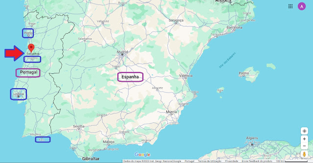
40.493° N; 8.474° W
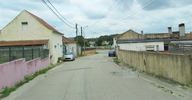
Sangalhos is a Portuguese village, home to the Parish of Sangalhos in the Municipality of Anadia, a parish with an area of 16.9 km² and 3,835 inhabitants (2021 census), thus having a population density of 226.9 inhabitants/km²
It was a town and county seat since the Middle Ages, with this status being confirmed or made official by the charter issued by Dom Manuel I in 1514. It remained the county seat until the first half of the 19th century.
Places
Casaínho; Fogueira; Paço; Paraimo; Póvoa do Castelo; Póvoa do Mato; Póvoa do Salgueiro;
Porto Lobo; Ribeiro; Sá; Saima; São João da Azenha; Sangalhos; Vidoeiro; Vila.
History
Archaeological remnants dating back to the Roman era presuppose a minor community within the territory of Sangalhos. The pre-Roman peoples of the region of the Vouga was already a mixture of races and cultures from the northern Europe and Mediterranean, but principally of Celtic or Turduli. The origin of its name sangalhos, which refers to a unit of measure, as hypothesized by Joaquim de Silveira, came from the cult of São Galo (Sanctus Gallus). The author placed the origin of its parish in the 7th century, during the Visigothic period. During the Roman era, the area was part of the Roman civitas Talabriga (Marnel, Lamas do Vouga).
The first documents that refer to Sangalhos date back to 957 A.D., and progress until the founding of the Portuguese Kingdom. In 1064, with the conquest of Coimbra, the lands of the Bairrada were liberated from the Moors. The hamlet of Sangalhos, appropriated by Count Sesnando, first and illustrious governor of Coimbra, was donated to the Church (and Hospital) of Mirleos, founded in the city of Mondego. But, by 1220-1221, during the administrative inquiries, Sangalhos and its parish Church of São Vicente, had already passed into the hands of the Crown. During this era, the parish consisted of two metropoles: its seat, Sangalhos do Paço (et alio Sancto Galios), and Sangalhos da Igreja (Sancto Galios), in addition to the localities of Saima, Sá, Casal da Rua and Avelãs de Caminho
The great monasteries of Lorvão, Vacariça, and Santa Clara de Coimbra dominated the activities in the region of the Bairrada. Santa Clara de Coimbra, founded by nun Mor Dias at the beginning of the 14th century, in who the patronage and lands of Sangalhos was entrusted after 1338. The first years were turbulent for the nun, who although a nun in the Order of the Holy Cross, was not supported by royal and Crusader donations. The intervention of Queen Elizabeth of Aragon, assisted resolving these disputes, and provided the authorization to build a new monastery in the name of Santa Clara and Santa Isabel.
In the 12th and 13th century, Sangalhos was one of the principal towns in the region, along with Horta (Tamengos), Recardães and Óis da Ribeira. It was selected by Afonso Henriques to be a test area for the use of the alqueire unit of measure in the distribution and productivity of lands. The alqueire, equivalent to Roman (8.733 litres), was adopted by the King around 1179, the same year that forals were bestowed on Coimbra, Santarém and Lisbon. In the archbishopric of Vouga and bishopric of Oporto, the Henriquino alqueire began to be referred to as the Sangalhos, sangalhês or sangalho. It was only in the 16th century, that this unit of measure fell into disuse, during King Manuel I of Portugal's reforms (although the reference continued to be used by many rural farmers).
In 1320, the church of São Vicente de Sangalhos was the most active church in the Bairrada and Baixo Vouga region.
Until the Middle Ages it was the municipal seat of its own territory (its foral was officially conferred in 1514 by King Manuel I of Portugal, during the King's administrative reorganization), although Avelãs do Caminho continued be a religious dependency of Sangalhos until the 19th century. By 1338, the land in Sangalhos was donated to the monastery of Santa Clara de Coimbra. This institution, which possessed the land during the next 500 years, was the primary motivator for settlement. As a result, Amoreira da Gândara, Fogueira, Paraimo and São João, all mentioned in the Manuelino foral, were increasingly active hamlets. As a component of the larger Archdiocese of Vouga, it was ruled by the Bishop of Coimbra, until it was later incorporated into Diocese of Aveiro (1774). By 1623, the monastery of Santa Clara de Coimbra received rents from 300 families and individuals working those lands; an area that included 2000 ha of semi-forested lands. By 1720, those rents had been significant enough to allow the construction of new chapel to the church through only one year's rents.
When Sangalhos reverted to a civil parish in the 16th century, it was incorporated into the burgh of Vouga, that also pertained to the municipality of Marnel, thus integrating Sangalhos into the comarca of Aveiro. Sangelhos became a regional military outpost, whose territory included many of the local parishes of the modern municipalities of Anadia, Oliveira do Bairro and Águeda. Divided in four companies, it was one of the more extensive military Captaincies of the region.
After the Liberal Wars (1820–1835), the donation to the monastery of Santa Clara de Coimbra was annulled and the municipalities of Sangalhos and Avelãs do Caminho (which became an independent parish within Anadia) became extinct. Similarly, the military Captaincy of Sangalhos was discontinued and Sangalhos became integrated into the municipality of Oliveira do Bairro, later São Lourenço do Bairro and, finally (1853), within the municipality of Anadia. As such, although geographically close to the neighboring city of Oliveira do Bairro, the parish was integrated into Anadia. By 1928, Amoreira da Gândara separated from Sangalhos to form a new parish.
Although the parish lost much of its politico-administrative importance, Sangalhos until the 20th century, prospered. Its inhabitants built many prosperous businesses that influenced the growth and development of the community, including pioneering bicycle production in Portugal and ceramics industry. Consequently, Sangalhos returned to the status of town in 1985 (Decrete-Law 65/85, 25 September).
Geography
Sangalhos is situated along a summit that overlooks the valley of the Cértima River, an area of ample vistas and vegetation that extends to the south towards Buçaco and east towards the summit of Caramulo (Caramulinho), known by locals as the Cesto Poceiro. Its central urban area is located 7.5 kilometres from the municipal seat of Anadia, and 24 kilometres southwest of the district capital (Aveiro). It is surrounded by the municipality and parish of Oliveira do Bairro, as well as Aguada de Baixo (in the municipality of Águeda), and its municipal neighbors Amoreira da Gândara, Mogofores, Ancas, Avelãs de Cima, Avelãs de Caminho, Paredes do Bairro, Arcos and São Lourenço do Bairro in the municipality of Anadia. The parish contains the settlements Fogueira, Paço, Paraimo, Póvoa do Castelo, Póvoa do Mato, Póvoa do Salgueiro, Porto Lobo, Ribeiro, Sá, São João da Azenha, Sangalhos, Vidoeiro and Vila.
Patrimony
Palace (Paço)
Dinis Abrantes residence with chapel
Chapels of Santa Eufémia, São Silvestre, Nossa Senhora do Bom Parto, São Francisco, Nossa Senhora das Dores, São João Baptista and São Geraldo
Oratory of Our Lady of Guia
18th century house in Fogueira
Saima's house
Wine cellars
Fountains of São João and Guimarães
Azenha de São João
Patrimonial wealth
The parish of Sangalhos preserves historical heritage from various eras. The oldest is movable heritage from the 15th century, including the images of the Virgin and Child, São Brás and Santa Catarina, all belonging to the parish church, and São Frutuoso, belonging to the Fogueira chapel. From the end of the 15th century or the beginning of the 16th century are the images of São João Baptista (São João da Azenha) and Santa Eufêmia (Sangalhos). From the beginning of the 16th century is the image of São Silvestre (Fogueira). The baptismal font in the parish church is Manueline (early 16th century), large and rare.
One of the oldest buildings still preserved, if not the oldest, is the chapel of São João da Azenha, built at the end of the 16th century or beginning of the next. The exterior arrangement of the São João chapel dates from the end of the 19th century. The altarpiece in this chapel, dating from 1642 and in the decadent Renaissance style, is the oldest in the parish. The Sangalhos cruise dates back to the 17th century.
The heritage inherited from the 18th century is a little more abundant. The oldest private houses still existing today in Paço, Vila and Fogueira date back to this century, with particular emphasis on the house of the Seabra Morais Araújo family (Fogueira). The Parish Church of São Vicente (1720) and the chapel of Nossa Senhora das Dores, de Sá (1741), date from the same century. The church is the largest and, artistically, one of the most valuable in Bairrada. The heritage inherited from the 19th century is more abundant, but less significant than that of the previous century.
The economic progress recorded throughout much of the 20th century left a significant heritage complex, consisting mainly of commercial and industrial buildings and numerous private residences, some with significant architectural value, located mainly in Sangalhos, São João da Azenha and Fogueira.
Roads
It has long been known that the Roman road passed through land that came to form the parish of Sangalhos. Currently, it is even thought that this road passed through the town of Sangalhos itself and that there was a mansion there, that is, a place where the emperor and high-ranking officials could spend the night. Since the average interval between mansions was around 45 km, there would only be two more on the road between Conímbriga and Bracara Augusta.
At the time of the founding of Portugal, north-south traffic would continue to pass through Sangalhos. In fact, it is known that the Moorish road (so called because it headed towards the territory dominated by the Moors), passed between Mogofores and Ancas in 1143. If, in Roman times, a mansion was located in Sangalhos on the Olisipo-Bracara road, natural is that the king of Portugal's overnight stay was also located in Sangalhos. A little evidence of this is the fact that Sangalhos remained a reguenga land until the 13th century, at least. Another piece of evidence is in the name of one of the neighborhoods of Sangalhos, precisely known as Sangalhos do Paço.
In the transition from the 12th century to the 13th century, the layout of the old Moorish road was rectified and the name itself fell into disuse, with the important road becoming known as the Coimbra road (because it headed to Coimbra), royal path or royal road. On its new route, it passed through Aguada de Baixo, São João da Azenha and Avelãs de Baixo (which became known as Avelãs do Caminho). In 1220, the royal palace was already located in Avelãs de Baixo, a sign that the layout of the road or royal path had been changed. A document from 1226 already calls the old Moorish road the old road and, on the other hand, refers to the passage of a Coimbra road between Mogofores and Arcos.
The parish of Sangalhos was also crossed by a road that connected Aveiro to Beira and Castile. It passed through the places of Sá, Casal da Rua (which got its name from this road) and Avelãs do Caminho.
The bushel of Sangalhos
Sangalhos had a significant regional projection in the 12th/13th centuries. This was confirmed with the choice of Sangalhos as the center for measuring Dom Afonso Henriques' bushel. This bushel, which was equivalent to the Roman modium (8,733 liters), was adopted by the founding king around 1179, the year in which the charters of Coimbra, Santarém and Lisbon were issued. These charters would serve as a model for many charters later passed to lands in the coastal center and south. In the archdeaconry of Vouga and the bishopric of Porto, the bushel of Dom Afonso Henriques ended up being known as the bushel of Sangalhos, sangalhês or sangalho. This measure only fell completely into disuse in the 16th century.
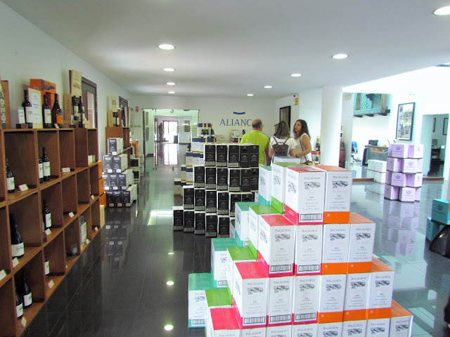
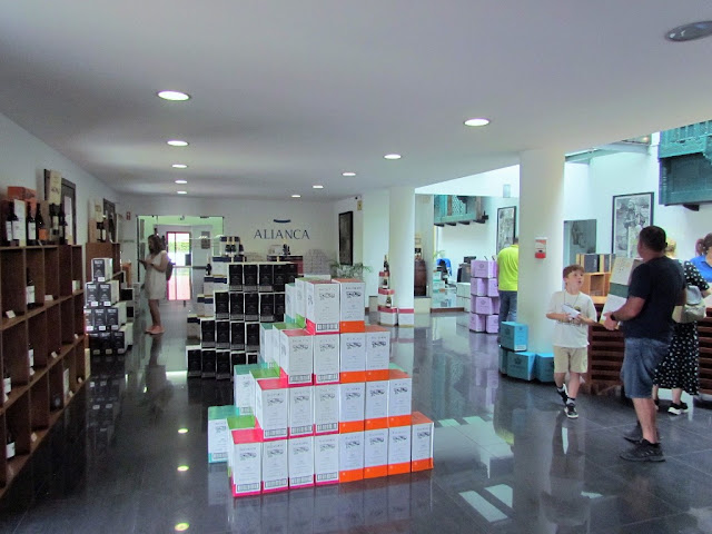
The Aliança Underground Museum is located in Sangalhos.
Aliança Underground Museum is the new project of the Berardo Collection, with collections from its collection.
Based in Sangalhos, Aliança Vinhos de Portugal decided to inscribe its brand on the art and culture label, presenting the municipality of Anadia with the Aliança Underground Museum.
A space that has seven collections that represent different imaginations, inviting the multitude of visitors to take a tour of the most different collections, in a meeting of people, places, beliefs and cultures.
This museum space, dreamed up by Commander José Berardo when he visited the Aliança cellars for the first time, has in its collection works of African art, ceramics from Caldas da Rainha, Rafael Bordalo Pinheiro's historical collection, tiles, minerals and fossils.
Guided Tours to ALIANÇA UNDERGROUND MUSEUM
Visiting Days: Monday to Sunday (closes January 1st, Easter Sunday, December 25th)
Time: 10:00; 11:30; 14:30; 4:00 pm
Cost: €3.00 (VAT included); Free visit for children up to 12 years old (inclusive).
Visit Duration: 1:30hrs
Capacity: maximum 50 people (per group)
Languages: Portuguese, English and French
Requires prior appointment by phone, fax or email. Subject to confirmation. For visitors without an appointment, the visit is based on availability.
GPS coordinates:
40°29'22.33"N
8°28'19.07"W

💓💓💓💓💓
SEARCH IN ALPHABETICAL ORDER
IN THE DISTRICT OF AVEIRO

Águeda;
Aguada de Baixo;
Albergaria-a-Velha;
Alvarenga + Paradinha;
Anadia;
Arões + Trebilhadouro;
Arouca + Meitriz;
Arouca Unesco Global Geopark;
Avanca;
AVEIRO;
Bussaco;
Castelo de Paiva;
Cortegaça;
Costa Nova;
Covelo de Paivó + Janarde + Drave;
Curia;
Esmoriz;
Estarreja;
Espinho;
Fábrica da Vista Alegre;
Freita Mountain (Serra da Freita);
Ílhavo;
Mealhada;
Murtosa;
Luso;
Oiã (Oliveira do Bairro);
Oliveira de Azeméis;
Oliveira do Bairro;
Ovar;
Palhaça (Aveiro);
Paramos;
Pateira de Fermentelos;
Praia da Barra;
Praia da Vagueira;
Ria de Aveiro;
Salreu;
Sangalhos;
Santa Maria da Feira;
São João da Madeira;
Sever do Vouga;
Silvalde;
Sosa (Vagos);
Vagos;
Vale de Cambra;
Válega;
Oliveira de Azeméis;
Oliveira do Bairro;
Ovar;
Palhaça (Aveiro);
Paramos;
Pateira de Fermentelos;
Praia da Barra;
Praia da Vagueira;
Ria de Aveiro;
Salreu;
Sangalhos;
Santa Maria da Feira;
São João da Madeira;
Sever do Vouga;
Silvalde;
Sosa (Vagos);
Vagos;
Vale de Cambra;
Válega;
Return to mainland Portugal &
the Azores and Madeira islands


